

OUR MISSION
Bridging the information gap between organisations and their impact and dependencies on climate and nature.
EXPERTISE
Geospatial Climate and Nature Intelligence for Financial Institutions and Corporates
Frontierra is a geospatial intelligence and analytics firm helping financial institutions, investment managers, and corporates understand and act on climate and nature risks and opportunities.
Using satellite data, earth observation data, and advanced geospatial data analysis, we deliver location-specific insights at the individual asset level, giving decision-makers a clearer and more accurate picture of real-world environmental exposure than sector- or country-level tools can provide.
Our services span four areas: climate risk, nature and biodiversity, deforestation monitoring, and value chain mapping. Each reflects deep specialist expertise, grounded in satellite data, geospatial analysis, and years of applied experience addressing some of the world's most complex environmental challenges.
Request a demo or get in touch to find out which service is right for your organisation.
WHY FRONTIERRA
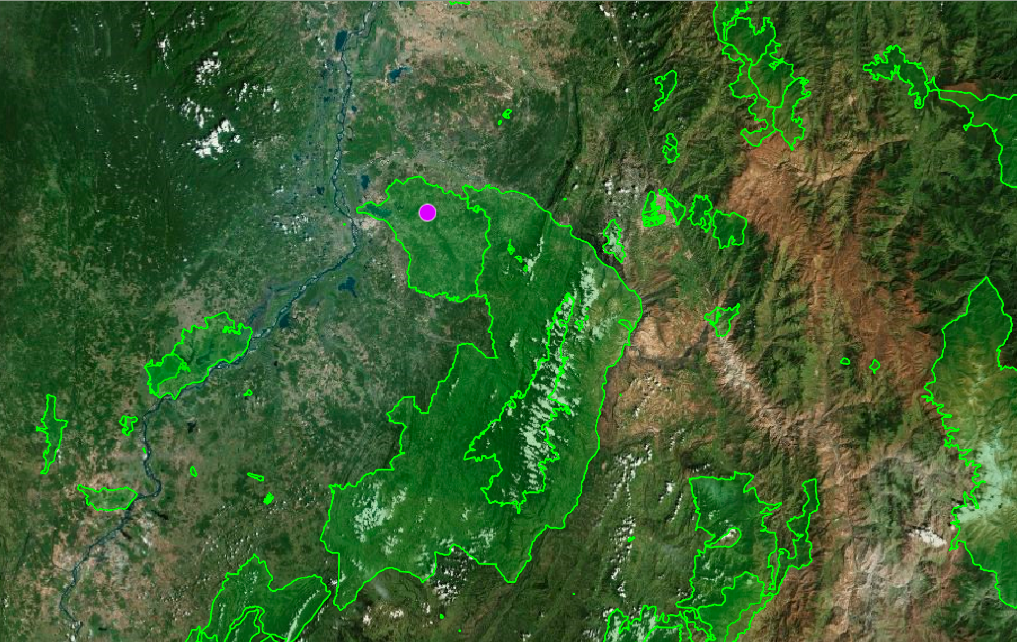
Most climate and nature risk tools work at the sector, country, or regional level. Frontierra works at the asset level.

Here is what that means in practice:
Location-specific analysis tied to the precise location and spatial footprint of each individual site avoids broad regional averages that can hide risk.
01
Satellite data and earth observation data powered by AI and geospatial analytics, so insights reflect real-world conditions on the ground.
02
Integrated climate and nature intelligence within a single platform, removing the need to manage multiple data providers
03
Depth and clarity of outputs designed to be acted on, not just filed for compliance.
04
Direct team experience in sustainable finance and environmental science, so our analysis reflects how these risks actually affect investment decisions.
05
How we can support you
OUR SERVICES
Service 01
Climate Risk Assessment
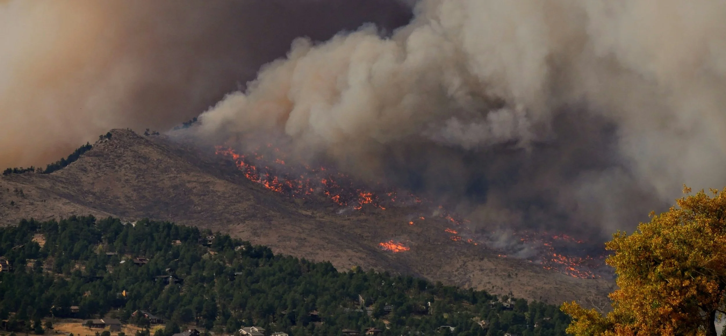
Frontierra's climate risk assessment service delivers location-specific analysis of physical and transitional risks, tied to the precise location and spatial footprint of your assets, not broad regional projections. Our platform evaluates over 35 hazard types across acute and chronic categories for every location across the globe.
Key applications:
Site selection and pre-investment due diligence for financial institutions, developers and asset managers
Asset- and portfolio-level risk management, climate risk screening and scenario analysis
Regulatory compliance and climate-related disclosure (ISSB S1 and S2, TCFD, EU Taxonomy, CSRD)
Every assessment provides actionable-insight so clients know where their exposure lies and what to do about it.

Service 02
Nature and Biodiversity: Risk and Opportunity
More than half of global GDP is estimated to be moderately or highly dependent on nature, yet most organisations have no systematic way to measure or manage that exposure, or to identify the opportunities that come with taking nature seriously.
Frontierra maps nature risks and opportunities at the asset level using satellite-derived metrics and proprietary indicators from a hierarchy of authoritative data sources, including government produced data and data produced by academic institutions and trusted NGOs.. These include Exposure to Nature-Related Issues (ENRI) rating for risk, and the Opportunity for Nature-Positive Practices (ONPP) rating for opportunity.
Key applications:
Pre-investment nature risk and opportunity due diligence
Nature dependency and impact screening across asset portfolios
Nature-positive strategy and risk management development for corporates and financial institutions
TNFD-aligned disclosure and biodiversity risk and opportunity assessment
Together, these give clients a clear framework for prioritising action and supporting TNFD-aligned disclosure, with actionable guidance on next steps alongside every assessment.
Service 03
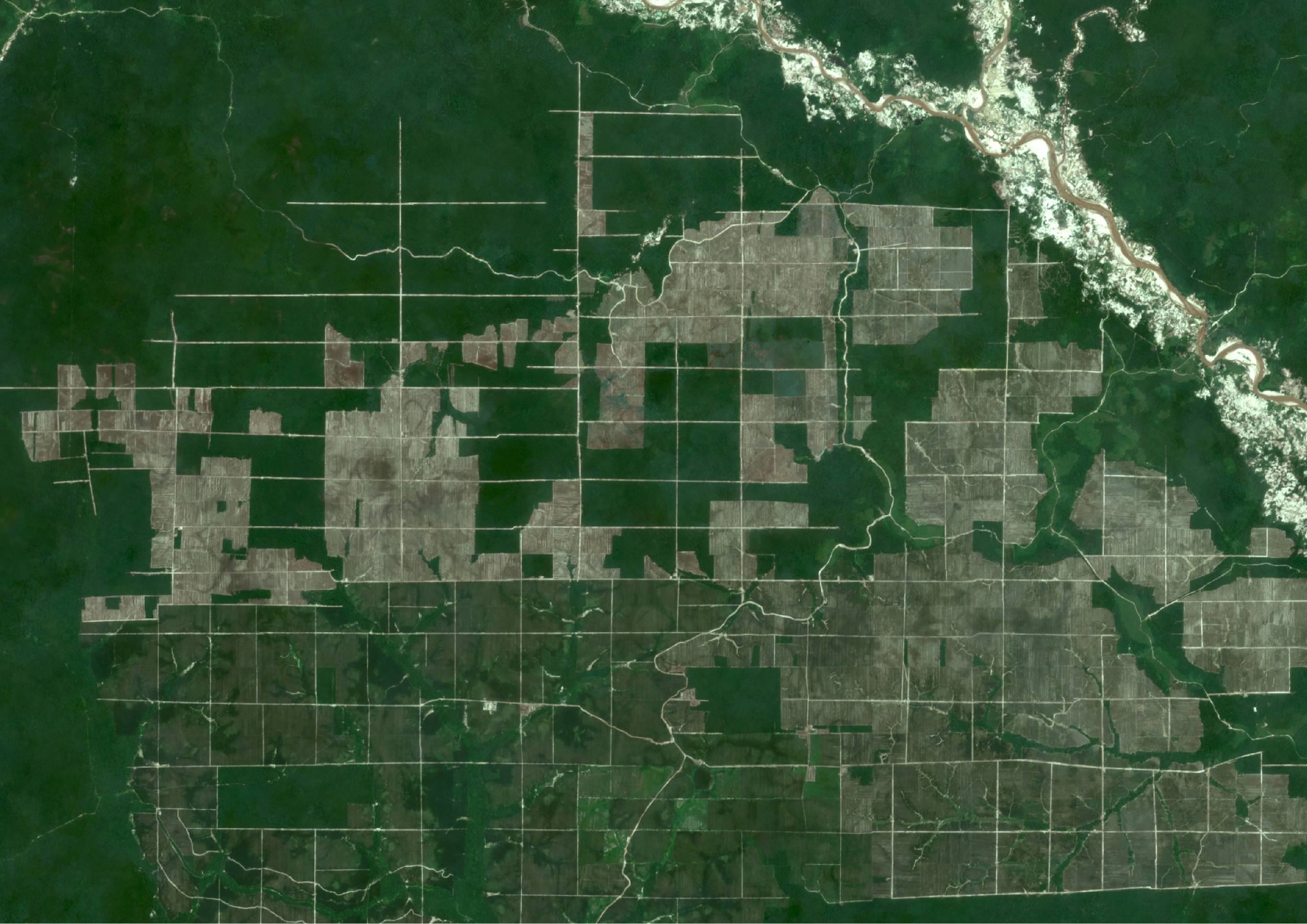
Deforestation Monitoring and EUDR Compliance
The EU Deforestation Regulation (EUDR) requires companies to demonstrate that the commodities they buy or sell are not linked to deforestation after 31 December 2020. Non-compliance carries significant penalties, including fines of up to 4% of annual EU turnover. Self-reported questionnaires no longer offer sufficient protection against regulatory and financial risks posed by deforestation.
Frontierra uses high-resolution satellite imagery and earth observation data to deliver evidence-based deforestation assessments across sourcing locations, portfolios, and supply chains, covering commodity based industries such as: beef, palm oil, soy, rubber, cocoa, coffee, and wood products. You get clear, actionable recommendations, not just data, so you know exactly which assets require attention, engagement and what steps to take next.
Key applications:
Deforestation risk screening for investment portfolios and lenders
EUDR compliance and due diligence statement production
Supply chain deforestation exposure assessment for food, agriculture, and consumer goods companies
Pre-regulatory readiness for financial institutions with agricultural exposure

Service 04
Mapping Value Chains
For many businesses, the most material climate and nature exposure sits upstream or downstream in the suppliers and sourcing regions that underpin their operations. For financial institutions, that exposure lies within investment or lending portfolios. Frontierra's value chain mapping service applies geospatial data analysis to trace environmental risks across global supply chains and portfolios.
Key applications:
Environmental due diligence for suppliers, M&A, lending, and investment decisions
Mapped risk profiles across sourcing geographies
Climate and nature risk exposure analysis across complex, multi-tier supply chains
Traceability analysis to support CSRD, EUDR, and TNFD reporting
Clients receive clear, prioritised recommendations alongside the data.
Frameworks We Support
Frontierra's services are aligned with the regulatory and voluntary frameworks that govern climate and nature disclosure for financial institutions and corporates:
REGULATORY & VOLUNTARY
International Sustainability Standards Board: global baseline requirements for sustainability and climate-related financial disclosures
ISSB S1 and S2
Taskforce on Nature-related Financial Disclosures: Nature dependency and impact identification and reporting.
TNFD
EUDR
EU Deforestation Regulation: Verification that commodities are not linked to deforestation.
Corporate Sustainability Reporting Directive: Environmental, social, and governance risk and impact reporting for large EU-operating companies.
CSRD
Climate Risk and Vulnerability Assessment: criteria for classifying sustainable economic activities
EU Taxonomy and CRVA
Regulatory alignment is a key output of our work, but the primary value is practical: understanding and managing the underlying risks, not simply meeting a disclosure requirement.
Find out which service is right for your organisation
CONTACT US
Request a demo or get in touch with the Frontierra team to discuss your requirements.