
SERVICE 04
Geospatial Supply Chain and Location Mapping for Climate and Nature Risk
For a lot of businesses, the most significant climate and nature risks do not sit within directly owned assets. They sit upstream, in the supply chains, sourcing regions, and land-use patterns that underpin day-to-day operations.
Frontierra’s value chain mapping service uses satellite data and geospatial analysis to trace environmental risks across global supply chains, giving decision-makers a clear, evidence-based picture of where material risks are concentrated and how they flow. For financial institutions, that exposure lies within investment or lending portfolios.
For more information, get in touch or request a demo to find out how Frontierra can support your organisation.
THE LOCATION GAP
The Problem with Incomplete Asset Location Data
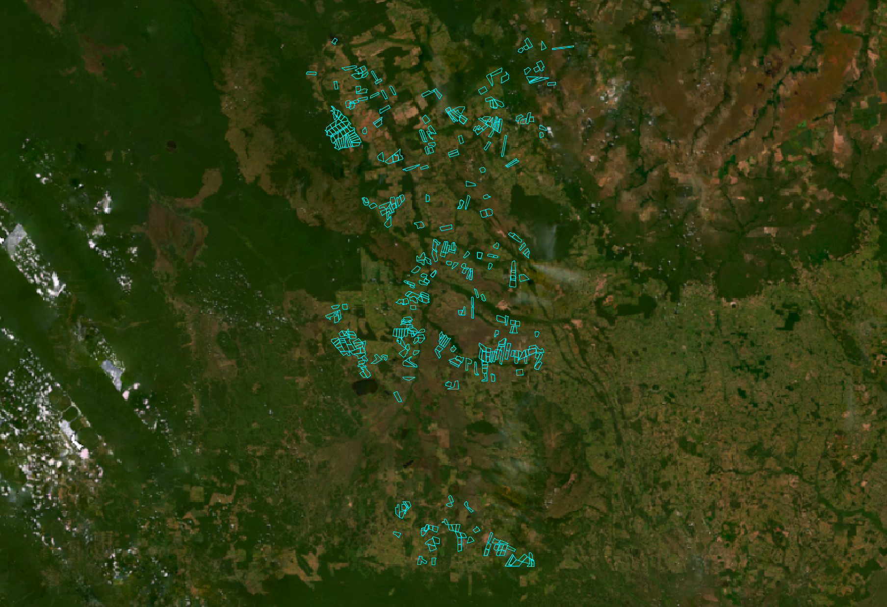
Most financial institutions and corporations begin climate and nature risk programmes with a fundamental gap: they do not know precisely where their assets, suppliers, or sourcing locations are. Portfolios are frequently managed using sector or country-level insight only. Supply chain data relies on self-reported questionnaires or policy evaluations. Sourcing records are fragmented across business units or third-party intermediaries.
This gap is equally acute for physical climate and nature risk assessment. Climate and nature impacts do not manifest uniformly across regions or sectors; they are inherently location-specific. Two assets in the same industry, or even the same country, can face fundamentally different exposures depending on where they sit: whether a facility lies within a floodplain or above it, in a water-stressed catchment or a water-abundant one, in a landscape with increasing wildfire frequency or minimal fire risk, or adjacent to a degraded ecosystem versus an intact one. Assessing physical risk at sector or country-level produces results that are statistically averaged and operationally misleading. For companies planning climate adaptation, managing nature dependencies, or stress-testing assets under future scenarios, the starting point is always the same: knowing precisely where the asset is.
THE CONSEQUENCE
Location-Specific Risk
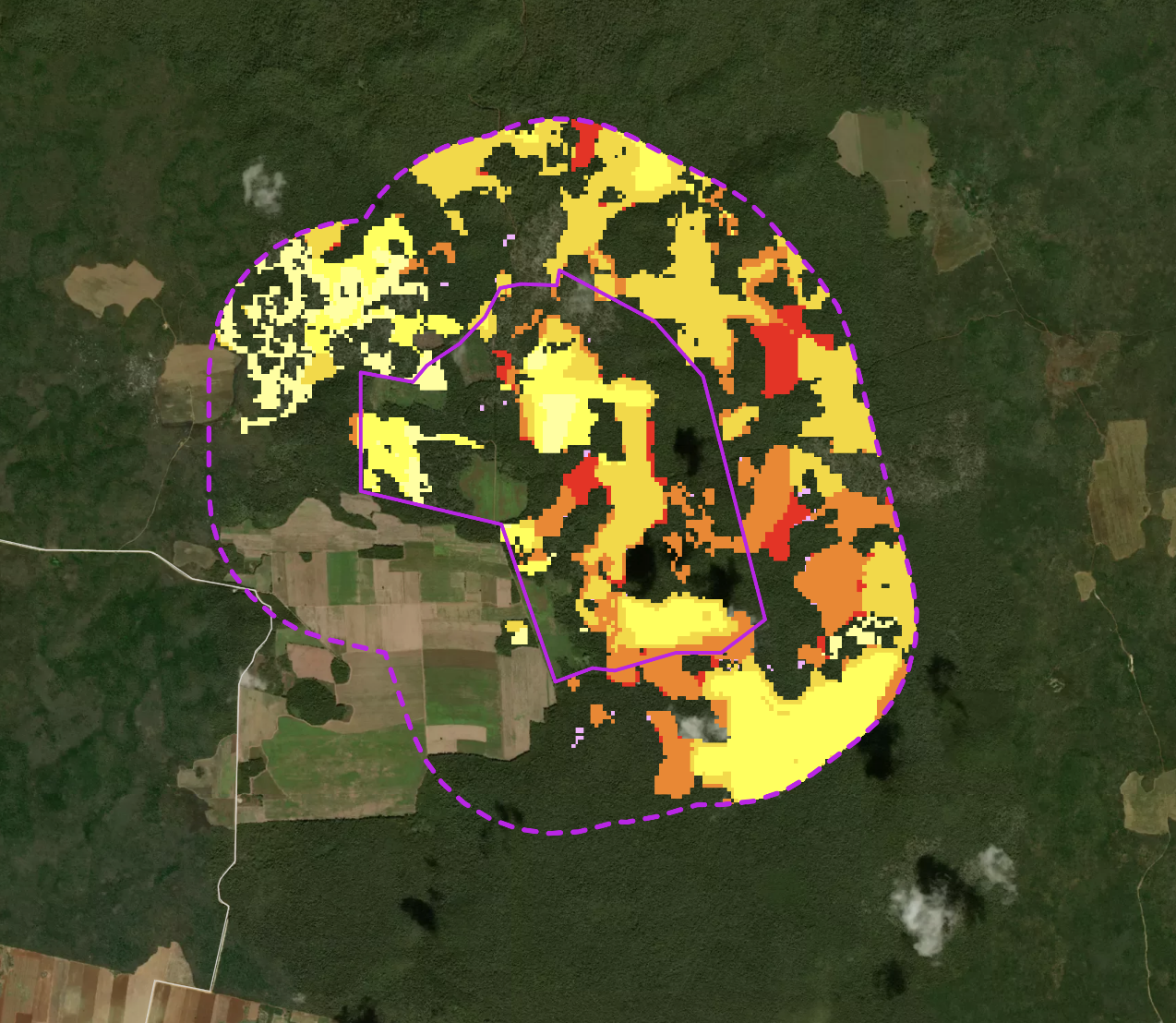
The practical consequences of this data gap are significant. Climate and nature risk assessments built on incomplete or imprecise location data produce inaccurate results, overstating risk in some areas and missing it entirely in others.
Compliance obligations and expectations under frameworks such as the ISSB S1 and S2 frameworks that have now superseded TCFD, the EU Deforestation Regulation (EUDR) and the Taskforce on Nature-related Financial Disclosures (TNFD) require organisations to demonstrate what they know about specific locations, not broad regions. Under CSRD, organisations are expected to assess and disclose supply chain impacts at a level of specificity that sector-level data cannot support.
For financial institutions, SFDR's Principal Adverse Impact indicators increasingly require location-sensitive data to demonstrate meaningful assessment rather than proxy estimates. And in pre-acquisition due diligence, an asset assessed against the wrong coordinates or a sector-level benchmark can carry hidden exposure that only becomes visible after the transaction completes.
Accurate, location-specific asset data is the starting point for any meaningful climate or nature risk programme. Frontierra’s geospatial supply chain mapping service establishes that foundation, resolving location data and applying satellite-derived analysis at the asset level, globally.
THE SOLUTION
How Frontierra Can Help Supply Chain and Asset Location Mapping
01 Building Your Location Database
Many organisations begin without a complete picture of where their assets or suppliers sit. Location data is often fragmented across spreadsheets, documents, and internal systems, or missing entirely. Frontierra works with clients at every stage of that journey, sourcing and consolidating whatever data exists into a single, analysis-ready geospatial database. For portfolio managers, we can also build asset location databases for listed companies using open-source data. Whatever your starting point, there is always something to work with, and a location-specific assessment will always outperform one built on sector or country-level proxies.
02 Climate and Nature Risk Assessments
Once assets and sourcing locations are accurately mapped, Frontierra’s Climate and Nature Intelligence Platform can assess climate risk and nature risk and opportunity at each individual location. This means physical climate hazards such as flooding, extreme heat, and drought are evaluated against the precise footprint of each site, rather than regional averages.
The same applies to nature dependencies and impacts. Proximity to protected areas, Indigenous territories, and sensitive habitats is assessed at asset level, enabling clients to identify which locations require further scrutiny and which present opportunities for nature-positive practices. This precision is what separates a credible risk assessment from a broad screening exercise.
03 Deforestation Exposure Mapping for EUDR
Under EUDR, companies and financial institutions must verify that the commodities they source, trade, or finance are not linked to deforestation after 31st December 2020. That verification requires plot-level location data, not supply chain averages. Frontierra’s deforestation monitoring service applies satellite analysis to every sourcing location identified in a client’s database, establishing forest cover at the baseline and identifying any deforestation or degradation since.
Value chain mapping is the prerequisite for this work. Where clients lack complete sourcing location records, Frontierra can support the process of resolving and structuring that data before the satellite analysis begins. The result is a compliant due diligence statement built on verifiable, evidence-based data rather than supplier self-declaration.
04 Sustainable Investment Fund Screening
Investment managers building sustainable or ESG-aligned funds need to understand the environmental exposure of the assets they hold or are considering. Broad sector classifications and ESG scores from data providers frequently miss the location-specific risks that determine whether an asset is genuinely aligned with sustainability criteria.
Frontierra’s supply chain mapping enables fund managers to screen portfolios and pipeline assets against location-level climate and nature risk data, providing the depth of insight needed to support credible sustainability claims, meet investor expectations, and align with frameworks such as ISSB S1 and S2, SFDR, TNFD, and the EU Taxonomy. Access Frontierra’s Climate and Nature Intelligence Platform to see how this works in practice.
05 Pre-investment Due Diligence
Environmental due diligence is increasingly a material consideration in investment decision-making, M&A activity and lending. Climate-related risks affecting a target asset, such as flood exposure, water scarcity, or proximity to nature-sensitive areas, can affect asset valuation, insurability and long-term operational performance.
Frontierra’s Climate and Nature Intelligence Platform provides location-specific clear, actionable recommendations, not just data, which can prioritise and drive asset level stewardship. Get in touch to find out more or request a demo.
Start with the Right Data
Every reputable climate and nature risk assessment depends on the quality of the underlying location data. Frontierra’s geospatial supply chain mapping service ensures that data is accurate, complete, and ready to support assessment, disclosure, and compliance across your operations and investments.
Ready to get started? Request a demo of the Frontierra Climate and Nature Intelligence Platform.
Frequently Asked Questions
-
Geospatial supply chain mapping uses satellite data and spatial analysis to identify and verify the precise locations of assets, suppliers, and sourcing regions across a business or investment portfolio. By attaching accurate coordinates to supply chain data, organisations can run location-specific climate and nature risk assessments rather than relying on sector- or country-level averages.
-
Climate hazards such as flooding, heat stress, drought, wildfire and sea-level rise vary significantly at the local level. A risk assessment based on a regional average or a sector proxy can miss exposure that only becomes visible when the actual asset location is mapped. Frontierra’s approach ties every assessment to the precise footprint of each site, producing more accurate and actionable results.
-
Frontierra’s value chain mapping and geospatial supply chain analysis supports compliance and disclosure under ISSB S1 and S2, TCFD, EUDR, TNFD (including the LEAP approach), EU Taxonomy, and SFDR. The service is also used for pre-acquisition environmental due diligence and sustainable fund screening.